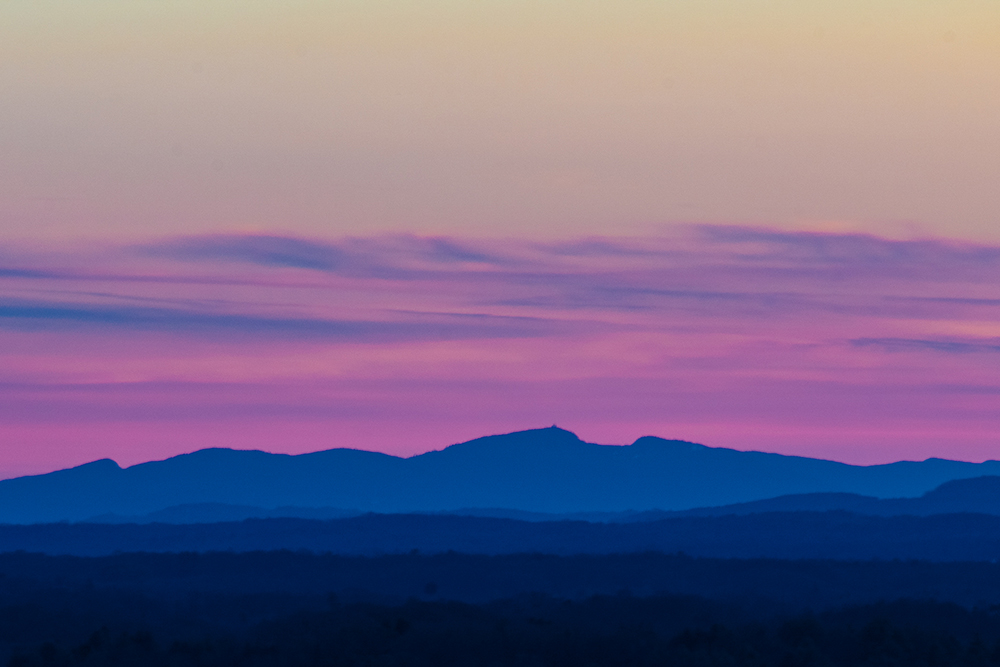
This winter has featured a bit of four-season weather – sometimes all in the same day – with chances to enjoy the Preserve’s great outdoor and indoor activities.
In this issue of Ridgelines, we’ll review a century of peregrine protection on the ridge, preview exciting updates to Rock The Ridge, and highlight expanded use of GIS (Geographic Information Systems) in our conservation work.
Thanks to all our members and donors for your generous support of our Giving Tuesday and Year-end appeals, and we wish you a happy and healthy 2025!
Banner photo by June Archer
Celebrating a Century of Peregrine Protection
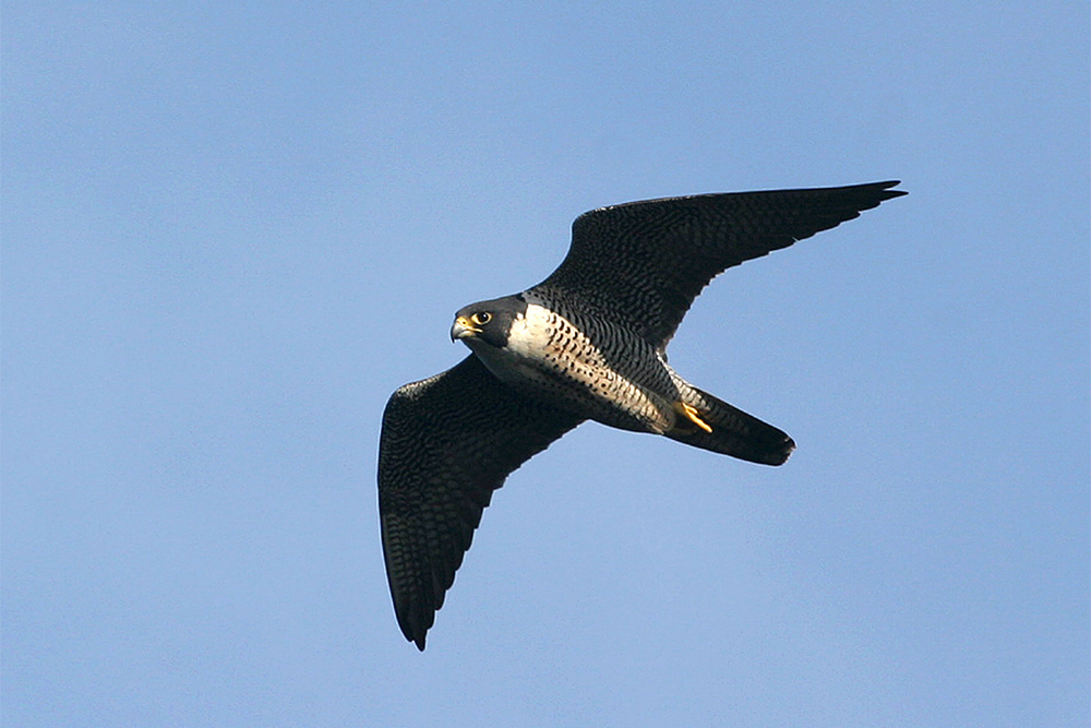
This year, Mohonk Preserve will continue a tradition of monitoring and conservation of peregrine falcons that began in the 1920s when Dan and Keith Smiley started recording and tracking this species. Dan would continue observing peregrines throughout his lifetime and noticed a marked decline in their numbers in the 1940s and 1950s when DDT and other pesticides began wreaking havoc on bird populations. By 1968, there were no known peregrine eyries (nesting sites) east of the Mississippi River.
In 1974, a cooperative program was launched by Dr. Tom Cade, formerly of Cornell University, and Dr. Heinz Meng, formerly of SUNY New Paltz, to raise young falcons and release them on the Shawangunk Ridge near the site of some of the original eyries. In 1998, after an absence of over 40 years, peregrines returned to nest in the Gunks, as they have in every year since then.
Since 1999, when the Preserve’s Peregrine Watch program was established, staff and volunteers have identified 65 breeding events for peregrine falcons in the Trapps, Bonticou Crag and Millbrook cliffs, resulting in 23 successful fledgling events. In 2005, a peregrine was banded at the Preserve for the first time in 50 years.
In 2022, after extensive research into peregrine conservation efforts nationwide, the Preserve introduced a responsive management approach to our temporary cliff closures at the beginning of the breeding season to provide the best chance for successful eyrie selection.
In 2024, in conjunction with the Preserve Ranger staff, we introduced our Peregrine Cam, which captures videos of the peregrines in action. The Preserve’s Conservation team also hosted Jane Maloney as our Guiseppe Traverso Intern. Jane’s project was to compile all relevant peregrine falcon data into an easily shareable and useable database, including past eyrie locations, climbing closure extents, and reproductive success rates (eyrie successes & failures). Through Jane’s investigative and curation efforts, we successfully created that database.
Based on this research, evidence points to predation being one of the driving factors that leads to an eyrie failure. Some potential predators of peregrine falcon chicks include great-horned owls, common ravens and eastern rat snakes. Further analysis of the data is planned to examine how reproductive success of an eyrie is influenced by extreme weather events and how the width of rock-climbing closures may impact peregrine falcon behavior.
This year’s temporary cliff and boulder closure begins on February 1 in conjunction with peregrine breeding season to optimize successful eyrie selection. Once an eyrie is successfully established, the closure will be adjusted based on its location.
Throughout the season, Preserve staff and volunteers will be monitoring the returning peregrines as part of our Peregrine Watch program. To follow the peregrines’ progress, click here for Peregrine Watch updates and videos.
There’s a Distance for Everyone at Rock The Ridge!
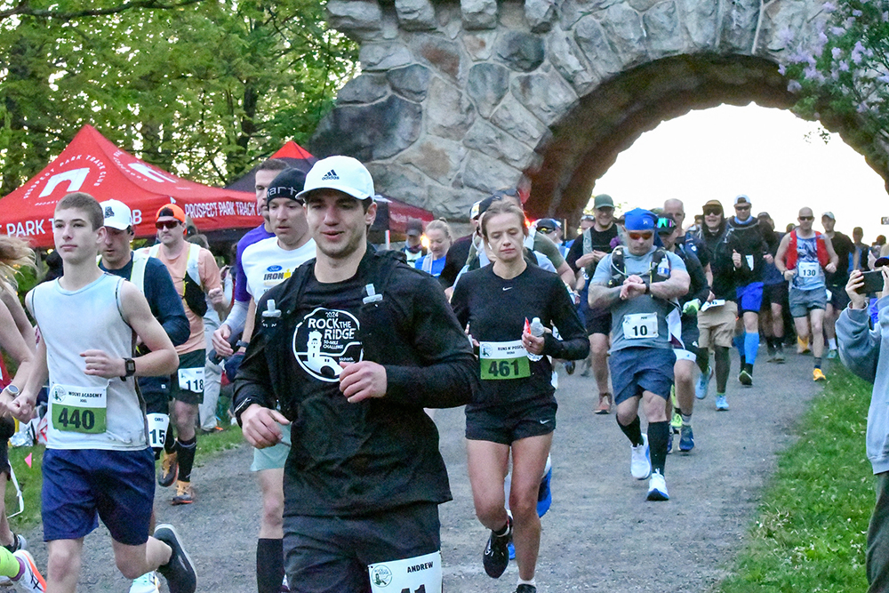
As daylight hours increase, it reminds us that spring is just around the corner. That means it’s time for the Preserve’s largest annual fundraising event, Rock The Ridge! Now in its 12th year, Rock The Ridge continues to grow by word of mouth from past Ridge Rockers who just can’t say enough great things about the event. With a generous 18-hour cutoff time and frequently situated aid stations, Rock The Ridge appeals to both experienced ultra runners and first-time ultra marathoners.
“Putting on a large-scale event such as Rock The Ridge is a real team effort from staff and volunteers,” said Special Events Manager and Race Director Tom Leader. “Our Stewardship team works hard leading up to event day to make sure the carriage roads are in top shape and our Ranger team not only marks the 50-mile course but is on duty race day to assist with any safety issues that arise,” Tom added. “Our over 130 dedicated volunteers help with sign in, aid stations, course marshalling and all the amazing photos capturing the event. I love to watch this team operate on event day and really showcase to first time Ridge Rockers why Mohonk Preserve is so special to so many people.”
This year Ridge Rockers can experience a new marathon distance option (26.2 miles), attracting another group of runners and hikers who may not be quite ready to go the full 50-miles, but who still want to challenge themselves and help raise money for the Preserve. “It’s a trail marathon that’s done on our beautifully groomed carriage roads following the same course as legs one and two of Rock The Ridge,” Tom said. “Registrations for the first ever marathon at the Preserve are pacing well and we expect to fill all 100 marathon slots this first year.”
“If the full 50-miles or marathon distances are too ambitious, there’s always the relay option,” Tom noted. “Grab three friends and create a team with each person running or hiking between 10–13 miles of the course. It’s a fantastic day on the ridge whether you’re doing the full 50, marathon or one relay leg. Last year’s Rock The Ridge welcomed a record 87 relay teams!”
Rock The Ridge also features a fantastic finish line experience in the Event Village, with great food from Frank’s Fresh Pickling Co. in New Paltz, beverages from Arrowood Farms and Brooklyn Cider House, music, Rock The Ridge merchandise and enthusiastic spectators with an abundance of cowbells to cheer on participants as they cross the finish line under the Testimonial Gateway Arch.
Since 2013, Ridge Rockers have helped raise more than $2.4 million to support the Preserve’s programs which introduce kids to nature, monitor and mitigate the effects of invasive species on the land, repair and resurface the network of carriage roads, and welcome more than 300,000 annual visitors to be inspired by nature.
Interested in participating in Rock The Ridge this year? Watch our event video here, and sign up today at www.mohonkpreserve.org/rock-the-ridge/. For sponsorship information please contact us at rocktheridge@mohonkpreserve.org.
Advancing GIS for Good
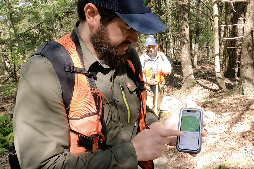
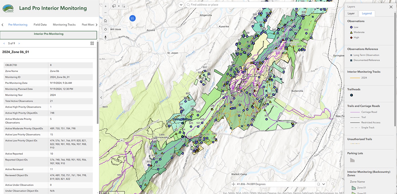
As New York’s largest nonprofit nature preserve, protecting over 8,200 acres of rare and diverse ecological communities is a critical part of the organization’s conservation-first mission. For over two decades, the Preserve has been using Geographic Information Systems (GIS) to help in the vital work of identifying and sharing information about species, habitats and recreation.
Heading up these efforts is Mohonk Preserve Associate Director of Land Protection and GIS Ed Pestone, who works across the organization to help implement and facilitate the use of GIS and related tools to foster collaboration for the Conservation & Community Education, Stewardship, Visitor Experience and Volunteer programs.
While GIS had long been used by the Preserve’s Conservation Science staff to conduct research projects and Land Protection staff for tracking monitoring efforts, in 2019, Ed and a multidisciplinary group of staff from across the organization embarked on the process of developing the Preserve’s first new trail maps in decades, employing GIS tools to create not only a new physical map, but also introduce a digital option. The new trail maps enhanced visitor experience and management, while minimizing environmental impact.
The Preserve’s multiple GIS databases include natural/environmental, cultural and built geographic features, and mobile data collection has facilitated databases including culverts, bridges, signage, water bars, trailheads, building and parking lots. Environmental datasets include forest types, protected lands, land management, and significant habitats and species. GIS mapping also supports grant applications, on-land projects and special events, such as course mapping, mile markers and aid stations for the Rock The Ridge trail challenge and Shawangunk Grit gravel ride.
Mohonk Preserve’s over 400 volunteers also benefit from the our GIS capabilities. Ed has been collaborating with Esri, the global market leader in GIS software, web GIS and geodatabase management applications, to highlight nonprofit GIS opportunities. Last fall, he discussed the Preserve’s use of Esri’s ArcGIS system as part of the webinar “Activate Volunteers and Enhance Community Collaboration,” hosted by Esri. Ed will also be a featured speaker at Esri’s upcoming Federal GIS Conference Session “GIS for Good: Nonprofit Patterns for Delivering Impact” on February 25, 2025, in Washington, DC. The session will explore how ArcGIS can help with donor management, volunteer engagement and impact assessment.
In May, Ed will be presenting on “Stewardship Technology and Volunteer Engagement” at the 2025 New York Land Conservation Conference in Glens Falls, New York. He and Cara Gentry from Wallkill Valley Land Trust will discuss efforts to coordinate and streamline field data collection by volunteers, give insight into experiences implementing technologies in their volunteer programs, and provide examples of how they are being used to carry out stewardship and community science projects. Ed will also be featured in an upcoming TechSoup article on Medium, “Leveraging Esri Tools to Transform Nonprofit Operations: Insights from Mohonk Preserve.”
“Mapping and GIS are integral parts of all aspects of managing the built and natural environment at Mohonk Preserve,” Ed noted. “I’m sure we will continue to see use of geospatial technologies by staff, volunteers and colleagues expanding in a wide variety of applications.”
New Year – New Plans
The new year brings a new opportunity to plan ahead and support the people and organizations you care about the most.
Mohonk Preserve has partnered with FreeWill to offer an accessible, no-cost resource to get started on your estate plan and align your legacy with your values. It’s a straightforward process that ensures your wishes are honored, your loved ones are cared for and the causes you support are acknowledged.
Start 2025 off right by creating a lasting gift to the people and places you love with FreeWill.
P.S. If you’ve already created an estate plan and included a legacy gift to Mohonk Preserve, but haven’t let us know yet, please fill out this form.
Seasonal Photo Gallery
View seasonal photographs by our volunteer photographers below!
See more photos by the Mohonk Preserve Volunteer Photographers on their Facebook page.
Seasonal Updates
GET INTO NATURE. See a full list of upcoming programs here including Hike with a Naturalist and Thursday Tales at Ten.
IN APPRECIATION. Go to our listing of Memorial and Honorary Gifts, Premium Members, and Business Members received October 1 through December 31, 2024.
CHECK THIS OUT.
Art Exhibit and Sale: The Natural Beauty of the Shawangunks in Winter, a group photography exhibition by the Mohonk Preserve Volunteer Photographers will be on display at the Visitor Center Gallery for the month of February, with photos available for purchase. Click here to learn more.
Get ready for Summer Camp 2025: Mohonk Preserve summer camp programs provide opportunities for children ages 4-13 to spend their summer outside enjoying the natural wonders the Shawangunk Ridge has to offer. Registration is open! Click here to see our summer camp program offerings.
Mohonk Preserve 2025 Calendars: Get yours today at the Visitor Center or order a calendar online! Available while supplies last.
Check out our upcoming exciting events:
- Registration is open for Rock and Snow Bridge 2 Bridge 5-Mile Run on April 5, 2025
- Registration is open for Rock The Ridge on May 3, 2025
- Save the date for the 28th Annual Benefit Auction on September 13, 2025
- Save the date for the Shawangunk Grit on November 1, 2025
Save the Date for Winterfest: Join the Gunks Climbing Coalition on March 16 for a full-day event with 20+ clinics taught by a diverse roster of local guides. Mohonk Preserve Rangers will also be there presenting SAR and rescue skills. Click here to learn more about Winterfest 2025.
MOHONK PRESERVE BUSINESS MEMBERS. Thank you to all our Business Members. See the full list of Mohonk Preserve Business Members in our area guide.
Subscribe!
Get quarterly Ridgelines and monthly Get Into Nature newsletters to your inbox.
"*" indicates required fields
